
- About Us
- Board of Directors
- Sections
- Guiding Documents
- Join APA and Its Divisions
- Contact Us
- Washington Planning Awards Information
- Events & Training
- Professional Development
- Sponsorship
- Get Involved
- Resources
Stepping Up To Climate Change - the Quinault Indian NationThe Ten Big Ideas Initiative is an APA Washington Chapter program designed to bring about far-reaching and fundamental change on a variety of issues. In this series, The Washington Planner will focus on communities taking action to respond to climate change, providing Washington APA members with more information on the work being done, and how they can take action in their community. This installment provides an overview of the series and focuses on the Quinault Indian Nation. Stepping up to address Climate Change at the state, regional, and local levels is one of the Ten Big Idea Initiatives. This work culminated in a short video focusing on the science of climate change, highlighting actions of three local communities, and a Resilient Washington document - 17 written discussion briefs addressing adaptation and mitigation strategies for local governments. The briefs are grouped in three sections - Planning Approaches for Resilience, Strategies for Planning Resilient Communities, and Preparing for Climate-Related Events. The video and discussion briefs can be found at http://www.washington-apa.org/address-climate-change. This series of newsletter articles will highlight local actions, reflecting the wide variety of our local communities and local geographies. You may be surprised and what’s been going on, and where! Our initial example demonstrates the role of planning in adaptation and resilience at an extreme – planning for the relocation of a community.
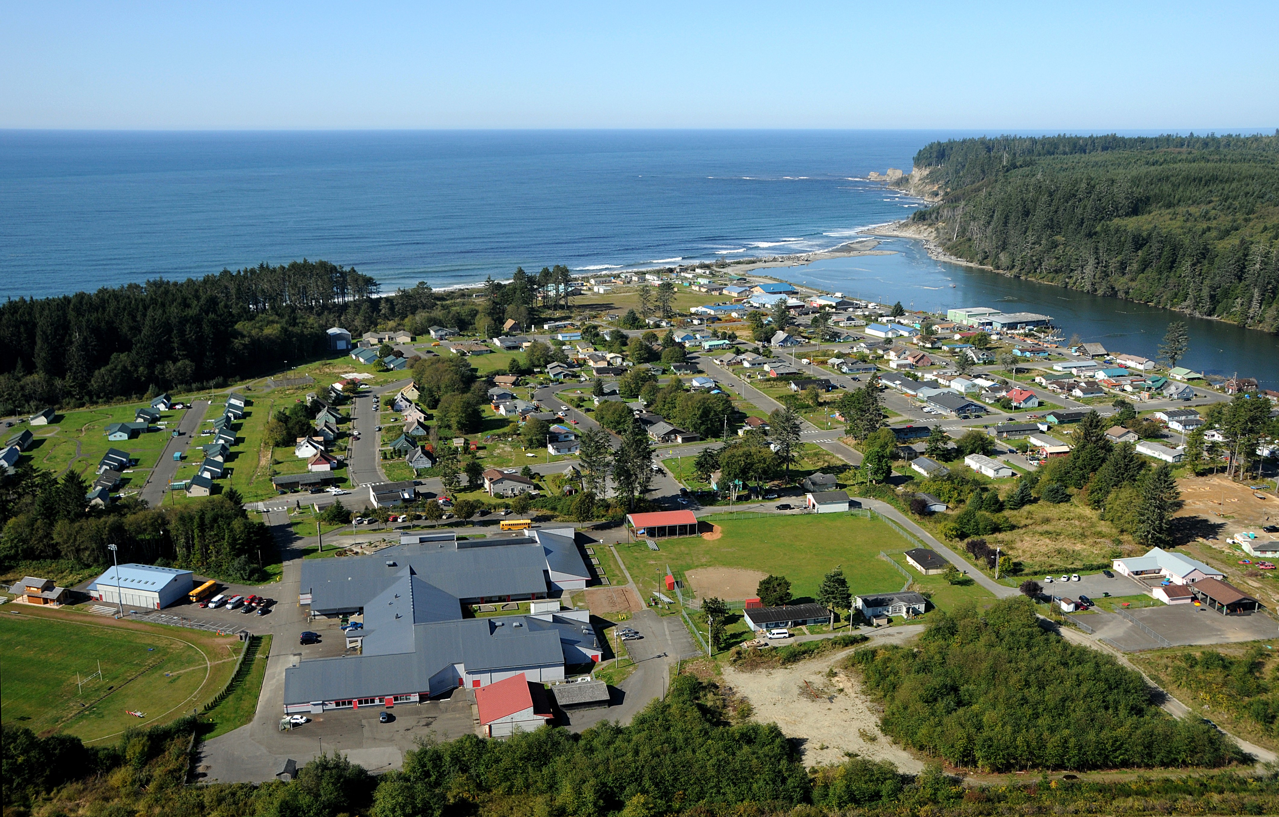
Taholah is located at the confluence of the Quinault River and Pacific Ocean, so it is particularly vulnerable. In March 2014, a storm surge breached the seawall that protects the village, resulting in a declaration of a state of emergency. The US Army Corps of Engineers repaired the seawall as a temporary measure. The severity and immediacy of this event, however, gave new urgency to formulate a sustainable, long-term solution to preserve the safety of the nearly 700 people who live in the flood and tsunami zones. At risk are tribal elders, children who live or attend school in the lower village, homes, the K-12 school, numerous community and commercial facilities, and infrastructure for water, sanitation, communications, and transportation.
The Master Plan will articulate land uses, private and public development standards, lot sizes, and the location and design of public buildings and facilities. The aim is to provide the residents and businesses of the lower village with the opportunity to move to a safer place, in a manner that ensures continuity in government service provision and affordable housing options for those that wish to relocate. The plan is scheduled for completion and adoption in late 2016. Because Taholah is reasonably isolated and likely will be among the last areas to receive emergency aid, the planning team is also examining the best ways for the village to be safe in the case of disaster. This includes backup power and emergency water supplies and armoring of the wastewater facilities. While a wide variety of activities related to climate change are being undertaken throughout our urban, rural, and resource areas, information about these activities isn’t always easy to find. We need your help to get the word out – so send us your stories! And let us know not only “what” you’re doing, but “how” you generated necessary community support. Please send your information to any member of our team: Jill Sterrett, Lyn Keenan, Laura Hudson or Nicole Faghin. |
 Village of Taholah Relocation - Quinault Indian Nation
 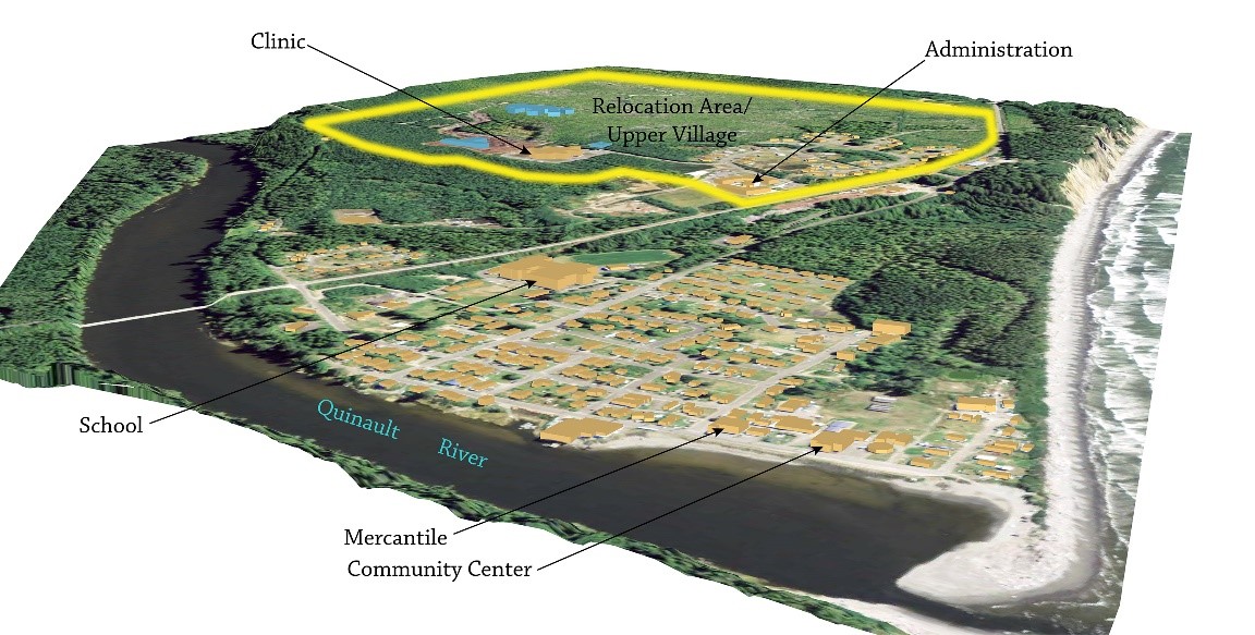 With support from the community, QIN leadership has made the difficult decision to begin planning for relocating Taholah to higher ground, ½ mile from the existing village center. Development of a master plan began in the spring of 2014. Relocation of a village requires extensive community engagement, thoughtful, detailed deliberation and planning, hard decisions and resources. Development of a master plan is a critical and necessary first step. At the end of the master planning process, the Nation will have a blueprint for redevelopment of the village, safe from sea level rise, storm surge, flooding and tsunamis. The plan will incorporate the vision of the community members, sustainable practices, culture, amenities and upgraded community facilities. The document will contain coordinated utility, land use, subdivision and phasing plans allowing for the construction of a new village. The Master Plan will provide a solid foundation to secure the funding and support needed for implementation.
Upcoming Events
Wed Sep 23, 2026MRSC Webinar - Implementing and Monitoring Local Climate Plans Webinar Category: APA WA Events |
View Full Calendar
The Washington Planner
APA Washington's Monthly NewsletterRead the latest issue>>
Submit an article>>
Sponsors